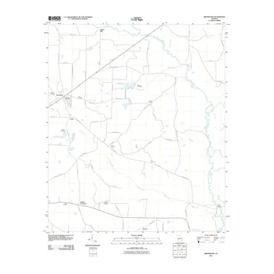
2011 Map of Bronwood
USGS Topo · Published 2011About this map
Bronwood sits at a crossroads of rail and road, anchored by its Bronwood Post Office and a grid of residential streets near Sugar Creek. The surrounding Terrell County landscape is defined by the winding course of Kinchafoonee Creek to the north and east, and the multiple branches of Middle Creek that cut through the agricultural territory. This 2011 survey reveals a deeply rooted community, documented through a significant number of cemeteries including Salem Cemetery, Greater Macedonia Cemetery, and Macedonia Cemetery, which are scattered among large tracts of land and family-named roads.
Find a feature on this map
62 named features on this map. Tap any name to fly to it.
Don’t see what you’re looking for? This feature index may not catch every label — zoom into the map to look around manually.
Map Details
Editions of this 2011 Bronwood Map
This is the sole edition of this map. No revisions or reprints were ever made.
Other maps of this area

1953 · Dothan
USGS Topo · 1:250,000

1954 · Dothan
USGS Topo · 1:250,000

1955 · Dothan
USGS Topo · 1:250,000

1956 · Sasser
USGS Topo · 1:62,500

1956 · Albany
USGS Topo · 1:62,500

1956 · Leslie
USGS Topo · 1:62,500

1973 · Chickasawhatchee
USGS Topo · 1:24,000

1973 · Sasser
USGS Topo · 1:24,000

1973 · Dawson
USGS Topo · 1:24,000
1973 · Bottsford
USGS Topo · 1:24,000