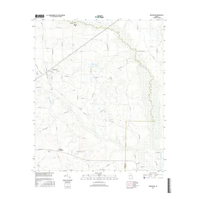
2017 Map of Bronwood
USGS Topo · Published 2017About this map
Bronwood serves as the central hub of this South Georgia landscape, where agricultural roads radiate toward quiet crossroads and family burial grounds. The winding course of Kinchafoonee Creek carves a deep path through the eastern portion of the map, fed by numerous tributaries like Sugar Cr and Middle Creek. Small water bodies such as Spear Lake and McGill Pond are scattered throughout the terrain, indicating the importance of local water management for the surrounding farms.
Find a feature on this map
72 named features on this map. Tap any name to fly to it.
Don’t see what you’re looking for? This feature index may not catch every label — zoom into the map to look around manually.
Map Details
Editions of this 2017 Bronwood Map
This is the sole edition of this map. No revisions or reprints were ever made.
Other maps of this area

1953 · Dothan
USGS Topo · 1:250,000

1954 · Dothan
USGS Topo · 1:250,000

1955 · Dothan
USGS Topo · 1:250,000

1956 · Sasser
USGS Topo · 1:62,500

1956 · Albany
USGS Topo · 1:62,500

1956 · Leslie
USGS Topo · 1:62,500

1973 · Chickasawhatchee
USGS Topo · 1:24,000

1973 · Sasser
USGS Topo · 1:24,000

1973 · Dawson
USGS Topo · 1:24,000
1973 · Bottsford
USGS Topo · 1:24,000