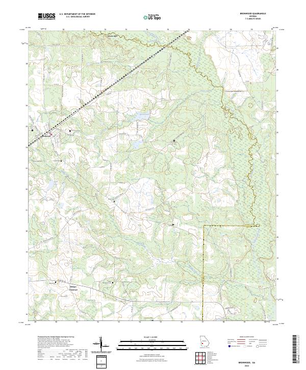
2024 Map of Bronwood
USGS Topo · Published 2024About this map
Kinchafoonee Creek and its many tributaries, including Chokeelagee Creek and Sugar Creek, define the landscape of this portion of Southwest Georgia. The settlement of Bronwood serves as a local hub, situated alongside a concentration of historical sites like the Old Church Cem and Bronwood Cem. Further north, Olivers Mill marks a traditional point of industry at the county line.
Find a feature on this map
74 named features on this map. Tap any name to fly to it.
Don’t see what you’re looking for? This feature index may not catch every label — zoom into the map to look around manually.
Map Details
Editions of this 2024 Bronwood Map
This is the sole edition of this map. No revisions or reprints were ever made.
Other maps of this area

1953 · Dothan
USGS Topo · 1:250,000

1954 · Dothan
USGS Topo · 1:250,000

1955 · Dothan
USGS Topo · 1:250,000

1956 · Sasser
USGS Topo · 1:62,500

1956 · Albany
USGS Topo · 1:62,500

1956 · Leslie
USGS Topo · 1:62,500

1973 · Chickasawhatchee
USGS Topo · 1:24,000

1973 · Sasser
USGS Topo · 1:24,000

1973 · Dawson
USGS Topo · 1:24,000
1973 · Bottsford
USGS Topo · 1:24,000