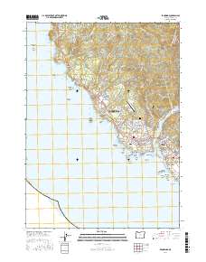
2017 Map of Brookings
USGS Topo · Published 2017About this map
Brookings and the neighboring community of Harbor define the southern Oregon coastline where the Chetco River meets the Pacific Ocean. This 2017 survey shows the coastal city's infrastructure, from the Brookings Airport and Southwest Oregon Community College to the residential grid extending toward the Ward Memorial Cemetery. The shoreline is heavily marked by prominent geological features and sea stacks, including Goat Island, Arch Rock, and Chetco Point. Further north, the landscape transitions into more elevated terrain near Cape Ferrelo and Sand Hill, with numerous small drainages like Lone Ranch Creek and Harris Creek cutting through the coastal hills. The map highlights the intersection of commerce and recreation, documenting the location of Harris Beach and Lone Ranch Beach alongside the critical transport corridor of Chetco Avenue.
Find a feature on this map
118 named features on this map. Tap any name to fly to it.
Don’t see what you’re looking for? This feature index may not catch every label — zoom into the map to look around manually.
Map Details
Editions of this 2017 Brookings Map
This is the sole edition of this map. No revisions or reprints were ever made.
Other maps of this area

1929 · Crescent City
USGS Topo · 1:125,000

1945 · Point St. George
USGS Topo · 1:62,500

1949 · Eureka
USGS Topo · 1:250,000

1952 · Crescent City
USGS Topo · 1:62,500

1954 · Coos Bay
USGS Topo · 1:250,000

1954 · Cape Ferrelo
USGS Topo · 1:62,500

1954 · Mt. Emily
USGS Topo · 1:62,500

1956 · Smith River
USGS Topo · 1:24,000

1958 · Eureka
USGS Topo · 1:250,000

1958 · Coos Bay
USGS Topo · 1:250,000