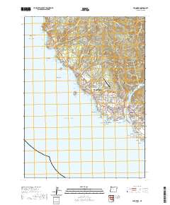
2020 Map of Brookings
USGS Topo · Published 2020About this map
The rocky coastline and timbered ridges of Curry County take center stage in this 2020 record of the Brookings and Harbor communities. The map captures the complex interaction between the Pacific shoreline and the steep coastal range, where features like Cape Ferrelo, Harris Butte, and Rainbow Rock define the maritime approach. The mouth of the Chetco River serves as the primary geographic anchor, separating the two main settlements and hosting several rocky hazards in the Chetco Cove, including Chetco Point and Yellow Rock.
Find a feature on this map
134 named features on this map. Tap any name to fly to it.
Don’t see what you’re looking for? This feature index may not catch every label — zoom into the map to look around manually.
Map Details
Editions of this 2020 Brookings Map
This is the sole edition of this map. No revisions or reprints were ever made.
Other maps of this area

1929 · Crescent City
USGS Topo · 1:125,000

1945 · Point St. George
USGS Topo · 1:62,500

1949 · Eureka
USGS Topo · 1:250,000

1952 · Crescent City
USGS Topo · 1:62,500

1954 · Coos Bay
USGS Topo · 1:250,000

1954 · Cape Ferrelo
USGS Topo · 1:62,500

1954 · Mt. Emily
USGS Topo · 1:62,500

1956 · Smith River
USGS Topo · 1:24,000

1958 · Eureka
USGS Topo · 1:250,000

1958 · Coos Bay
USGS Topo · 1:250,000