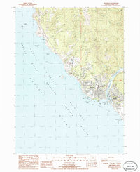
1986 Map of Brookings
USGS Topo · Published 1986About this map
Brookings and the community of Harbor define this coastal landscape at the mouth of the Chetco River in the mid-1980s. The map illustrates a developed shoreline where industrial and municipal infrastructure, such as the Sewage Treatment Plant and Water Treatment Plant, sit alongside extensive protected lands. The Chetco Cove coastline is heavily marked by rocky offshore features including Goat Island, Walrus Rocks, and Zwagg Island, all part of the Oregon Islands National Wildlife Refuge.
Find a feature on this map
59 named features on this map. Tap any name to fly to it.
Don’t see what you’re looking for? This feature index may not catch every label — zoom into the map to look around manually.
Map Details
Editions of this 1986 Brookings Map
This is the sole edition of this map. No revisions or reprints were ever made.
Other maps of this area

1929 · Crescent City
USGS Topo · 1:125,000

1945 · Point St. George
USGS Topo · 1:62,500

1949 · Eureka
USGS Topo · 1:250,000

1952 · Crescent City
USGS Topo · 1:62,500

1954 · Coos Bay
USGS Topo · 1:250,000

1954 · Cape Ferrelo
USGS Topo · 1:62,500

1954 · Mt. Emily
USGS Topo · 1:62,500

1956 · Smith River
USGS Topo · 1:24,000

1958 · Eureka
USGS Topo · 1:250,000

1958 · Coos Bay
USGS Topo · 1:250,000