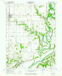
1962 Map of Brookston NW
USGS Topo · Published 1964About this map
The Tippecanoe Battlefield Memorial and nearby Battle Ground Campground anchor the southern reaches of this landscape, marking the historic site where the Harrison Creek and Burnett Creek converge. This region at the start of the 1960s is defined by its riparian geometry, where the Tippecanoe River winds through the eastern terrain to meet the Wabash River near Americus. The survey reveals a meticulously maintained rural infrastructure of family and community burial grounds, including Smelcer Cem, Barr Cem, and the Pretty Prairie Cem. The town of Brookston sits along the Monon railroad line in the northwest, serving as a hub for the surrounding agricultural Prairie. A network of country roads such as 800 North Road and 725 N Rd connects these scattered settlements, illustrating the mid-century transition of Indiana’s small-town and river-valley economies.
Find a feature on this map
42 named features on this map. Tap any name to fly to it.
Don’t see what you’re looking for? This feature index may not catch every label — zoom into the map to look around manually.
Map Details
Editions of this 1962 Brookston NW Map
3 editions found
Other maps of this area

1953 · Danville
USGS Topo · 1:250,000

1955 · Danville
USGS Topo · 1:250,000

1956 · Danville
USGS Topo · 1:250,000

1962 · Brookston SW
USGS Topo · 1:24,000

1962 · Monticello South
USGS Topo · 1:24,000
1962 · Round Grove
USGS Topo · 1:24,000

1962 · Templeton NE
USGS Topo · 1:24,000

1962 · Brookston NW
USGS Topo · 1:24,000

1962 · Monon
USGS Topo · 1:24,000

1962 · Monticello North
USGS Topo · 1:24,000