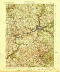
1926 Map of Brookville
USGS Topo · Published 1926About this map
Brookville serves as the central hub of this 1920s Pennsylvania landscape, where the waters of the North Fork and Coder Run meet to feed Redbank Creek. The topography is defined by the winding valley of Redbank Creek, which carves through townships like Clover and Beaver, creating a complex network of ridges and hollows. The era's transportation is dominated by the Lake Erie Franklin and Clarion RR and early segments of the Pennsylvania State Highway, which facilitated the movement of goods and people between rural outposts.
Find a feature on this map
92 named features on this map. Tap any name to fly to it.
Don’t see what you’re looking for? This feature index may not catch every label — zoom into the map to look around manually.
Map Details
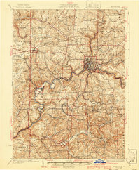
Editions of this 1926 Brookville Map
3 editions found

Other maps of this area

1901 · Rural Valley
USGS Topo · 1:62,500

1903 · Rural Valley
USGS Topo · 1:62,500

1906 · Clarion
USGS Topo · 1:62,500

1906 · Punxsutawney
USGS Topo · 1:62,500

1907 · Clarion
USGS Topo · 1:62,500

1909 · Smicksburg
USGS Topo · 1:62,500

1918 · Loleta
USGS Topo · 1:62,500

1922 · Tionesta
USGS Topo · 1:62,500

1922 · Du Bois
USGS Topo · 1:62,500

1924 · Du Bois
USGS Topo · 1:62,500