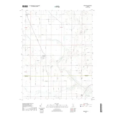
2018 Map of Broughton
USGS Topo · Published 2018About this map
The settlement of Broughton anchors this southern Illinois landscape, situated just north of the Hamilton County and Saline County boundary. The topography is defined by the winding course of the North Fork Saline River, which is fed by numerous tributaries including Contrary Creek, Lost Creek, and Rector Creek. The area's rural character is underscored by several family-named burial grounds and small communities like Texas City, Francis, and Dale. Genealogists will find particular value in the numerous recorded cemeteries such as Gholson Cemetery, Barker Cemetery, and the Gaines Family Cemetery. The map details an extensive network of county roads that crisscross the lowlands and slightly elevated ridges, illustrating the transition from open floodplains to upland farmsteads typical of the region in the late 2010s.
Find a feature on this map
80 named features on this map. Tap any name to fly to it.
Don’t see what you’re looking for? This feature index may not catch every label — zoom into the map to look around manually.
Map Details
Editions of this 2018 Broughton Map
This is the sole edition of this map. No revisions or reprints were ever made.
Other maps of this area

1905 · Eldorado
USGS Topo · 1:62,500

1906 · Eldorado
USGS Topo · 1:62,500

1908 · Galatia
USGS Topo · 1:62,500

1938 · Galatia
USGS Topo · 1:62,500

1941 · Enfield
USGS Topo · 1:62,500

1942 · McLeansboro
USGS Topo · 1:62,500

1944 · Enfield
USGS Topo · 1:62,500

1945 · McLeansboro
USGS Topo · 1:62,500

1949 · Paducah
USGS Topo · 1:250,000

1950 · Paducah
USGS Topo · 1:250,000