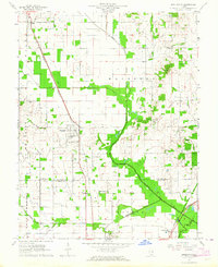
1963 Map of Broughton
USGS Topo · Published 1964About this map
The Louisville and Nashville railroad cuts a diagonal path through this Hamilton County landscape, anchoring the village of Broughton. During the early 1960s, this region remained a patchwork of small-scale agriculture and early extraction, evidenced by the Oil Field near Dale in the northwest corner. The social fabric of the era is clearly visible through a dense network of country churches and family burial grounds, including Shiloh Ch, Gholson Grove Ch, and the Latham Cem.
Find a feature on this map
35 named features on this map. Tap any name to fly to it.
Don’t see what you’re looking for? This feature index may not catch every label — zoom into the map to look around manually.
Map Details
Editions of this 1963 Broughton Map
This is the sole edition of this map. No revisions or reprints were ever made.
Other maps of this area

1905 · Eldorado
USGS Topo · 1:62,500

1906 · Eldorado
USGS Topo · 1:62,500

1908 · Galatia
USGS Topo · 1:62,500

1938 · Galatia
USGS Topo · 1:62,500

1941 · Enfield
USGS Topo · 1:62,500

1942 · McLeansboro
USGS Topo · 1:62,500

1944 · Enfield
USGS Topo · 1:62,500

1945 · McLeansboro
USGS Topo · 1:62,500

1949 · Paducah
USGS Topo · 1:250,000

1950 · Paducah
USGS Topo · 1:250,000