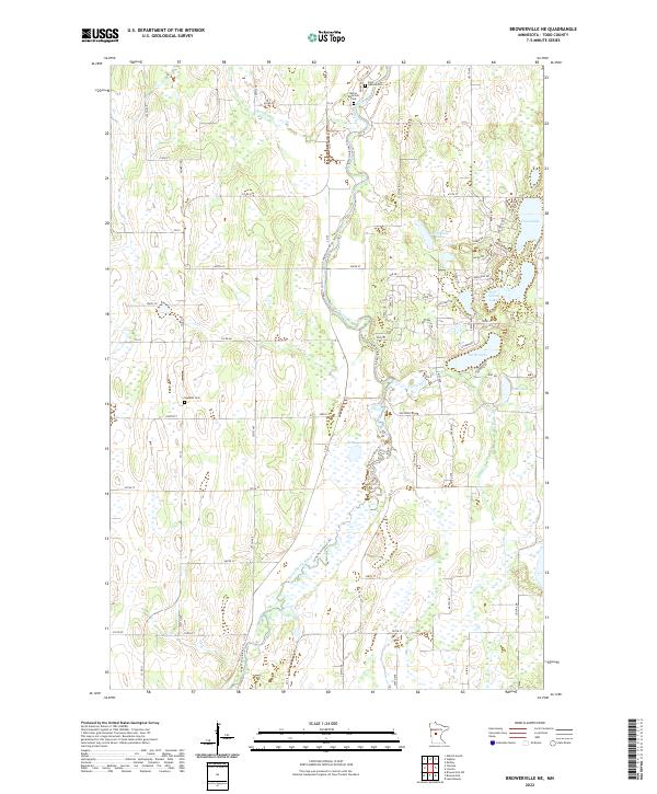
2022 Map of Browerville NE
USGS Topo · Published 2022About this map
The Long Prairie River Trl meanders through a landscape defined by glacial depressions and persistent wetlands in this portion of Todd County. The area’s spiritual and genealogical history is anchored by several burial grounds, including the Saint Isadore Cem and Moran Riverside Cem located in the northern sections, and the Swedish Cem further south. These sites provide critical data points for researchers tracing early settlement patterns in central Minnesota.
Find a feature on this map
59 named features on this map. Tap any name to fly to it.
Don’t see what you’re looking for? This feature index may not catch every label — zoom into the map to look around manually.
Map Details
Editions of this 2022 Browerville NE Map
This is the sole edition of this map. No revisions or reprints were ever made.
Other maps of this area

1948 · Cushing
USGS Topo · 1:62,500

1950 · Cushing
USGS Topo · 1:62,500

1953 · Brainerd
USGS Topo · 1:250,000

1957 · Brainerd
USGS Topo · 1:250,000

1958 · Brainerd
USGS Topo · 1:250,000

1963 · Motley
USGS Topo · 1:24,000

1965 · Brainerd
USGS Topo · 1:250,000
1966 · Browerville
USGS Topo · 1:24,000
1966 · Browerville NE
USGS Topo · 1:24,000

1966 · Staples
USGS Topo · 1:24,000