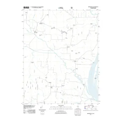
2011 Map of Brownfield
USGS Topo · Published 2011About this map
Brownfield and Hodgeville anchor this survey of Pope County, where the transition from higher ground toward the Ohio River is marked by a network of rural roads and numerous family cemeteries. The landscape is punctuated by landforms like Brownfield Bluff and Deputy Hill, the latter once serving as a sentinel point for the Deputy Lookout Tower. These elevated positions overlooked the winding course of Bay Creek as it moved toward the floodplain.
Find a feature on this map
53 named features on this map. Tap any name to fly to it.
Don’t see what you’re looking for? This feature index may not catch every label — zoom into the map to look around manually.
Map Details
Editions of this 2011 Brownfield Map
This is the sole edition of this map. No revisions or reprints were ever made.
Other maps of this area

1916 · Golconda
USGS Topo · 1:62,500

1917 · Brownfield
USGS Topo · 1:62,500

1920 · Goloonda
USGS Topo · 1:48,000

1921 · Golconda
USGS Topo · 1:62,500

1926 · Paducah
USGS Topo · 1:62,500

1929 · Smithland
USGS Topo · 1:62,500

1929 · Paducah
USGS Topo · 1:62,500

1936 · Smithland
USGS Topo · 1:48,000

1940 · Paducah
USGS Topo · 1:62,500
1942 · Smithland
USGS Topo · 1:62,500