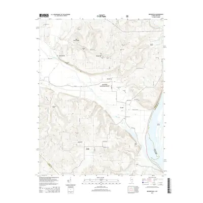
2015 Map of Brownfield
USGS Topo · Published 2015About this map
The Ohio River forms a prominent state boundary on this southern Illinois landscape, dividing Pope County from Kentucky. The terrain is defined by a dense network of creek valleys and ridges, with Bay Creek winding through the central portion of the quadrangle before approaching the river. This 2015 survey reveals a pattern of dispersed rural settlements, including Old Brownfield, Hodgeville, and Rosebud, each serving as a focal point for the surrounding agricultural and forest lands of the Shawnee National Forest.
Find a feature on this map
52 named features on this map. Tap any name to fly to it.
Don’t see what you’re looking for? This feature index may not catch every label — zoom into the map to look around manually.
Map Details
Editions of this 2015 Brownfield Map
This is the sole edition of this map. No revisions or reprints were ever made.
Other maps of this area

1916 · Golconda
USGS Topo · 1:62,500

1917 · Brownfield
USGS Topo · 1:62,500

1920 · Goloonda
USGS Topo · 1:48,000

1921 · Golconda
USGS Topo · 1:62,500

1926 · Paducah
USGS Topo · 1:62,500

1929 · Smithland
USGS Topo · 1:62,500

1929 · Paducah
USGS Topo · 1:62,500

1936 · Smithland
USGS Topo · 1:48,000

1940 · Paducah
USGS Topo · 1:62,500
1942 · Smithland
USGS Topo · 1:62,500