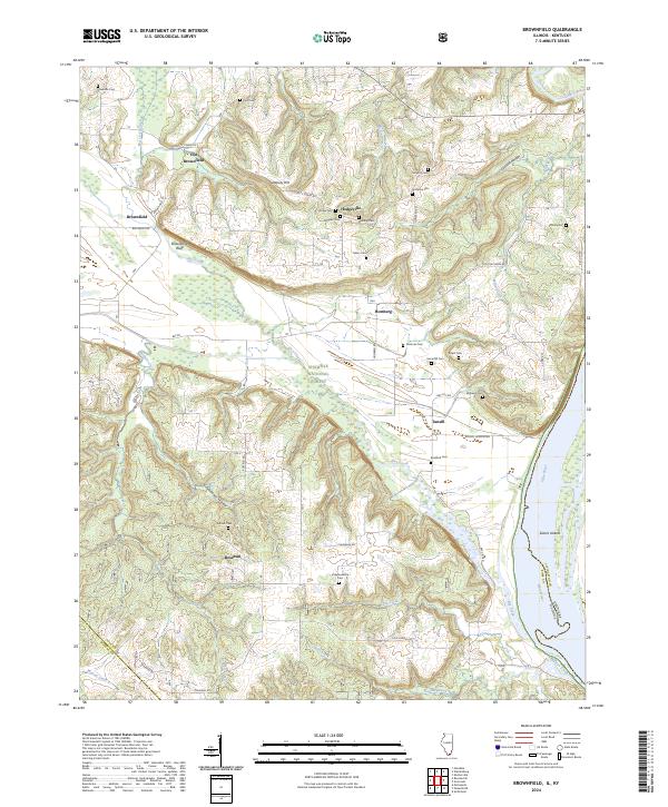
2024 Map of Brownfield
USGS Topo · Published 2024About this map
The Ohio River forms the eastern edge of this landscape, where Sisters Islands sit mid-stream at the Kentucky border. Inland, the terrain is defined by the winding course of Bay Creek, which cuts through the southern reaches of the Shawnee National Forest. This modern survey reveals a persistent rural settlement pattern where family-named landmarks like Deputy Hill and Brownfield Bluff overlook a network of small communities including Old Brownfield and Hodgeville.
Find a feature on this map
56 named features on this map. Tap any name to fly to it.
Don’t see what you’re looking for? This feature index may not catch every label — zoom into the map to look around manually.
Map Details
Editions of this 2024 Brownfield Map
This is the sole edition of this map. No revisions or reprints were ever made.
Other maps of this area

1916 · Golconda
USGS Topo · 1:62,500

1917 · Brownfield
USGS Topo · 1:62,500

1920 · Goloonda
USGS Topo · 1:48,000

1921 · Golconda
USGS Topo · 1:62,500

1926 · Paducah
USGS Topo · 1:62,500

1929 · Smithland
USGS Topo · 1:62,500

1929 · Paducah
USGS Topo · 1:62,500

1936 · Smithland
USGS Topo · 1:48,000

1940 · Paducah
USGS Topo · 1:62,500
1942 · Smithland
USGS Topo · 1:62,500