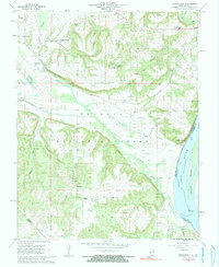
1962 Map of Brownfield
USGS Topo · Published 1991About this map
The Ohio River forms the southeastern border of this Pope County landscape, where the Sisters Islands sit mid-stream near Ropers Landing. Inland, the terrain is defined by the dense tracts of the Shawnee National Forest, punctuated by family-named cemeteries such as Foreman Cem and Hemphill Cem. Settlement patterns show a clear transition from the river lowlands to the higher ground of Brownfield Bluff, with clusters at Old Brownfield and the contemporary junction at Brownfield. The Illinois Central railroad cuts through the central valley, a critical artery for this rural economy. Significant local infrastructure of the early 1960s is preserved here, including the Community High Sch near the northern border and the Deputy Lookout Tower, reflecting a landscape managed for both timber and small-scale agriculture.
Find a feature on this map
54 named features on this map. Tap any name to fly to it.
Don’t see what you’re looking for? This feature index may not catch every label — zoom into the map to look around manually.
Map Details
Editions of this 1962 Brownfield Map
3 editions found
Other maps of this area

1916 · Golconda
USGS Topo · 1:62,500

1917 · Brownfield
USGS Topo · 1:62,500

1920 · Goloonda
USGS Topo · 1:48,000

1921 · Golconda
USGS Topo · 1:62,500

1926 · Paducah
USGS Topo · 1:62,500

1929 · Smithland
USGS Topo · 1:62,500

1929 · Paducah
USGS Topo · 1:62,500

1936 · Smithland
USGS Topo · 1:48,000

1940 · Paducah
USGS Topo · 1:62,500
1942 · Smithland
USGS Topo · 1:62,500