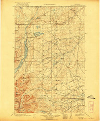
1903 Map of Browning
USGS Topo · Published 1921About this map
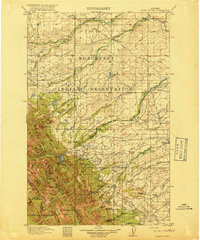
The Blackfeet Indian Reservation dominates this landscape at the turn of the century, captured during a period of significant boundary and land use transitions. The map illustrates the western edge of the reservation where it meets the newly established Glacier National Park, showing the early footprint of Browning and the Great Northern railroad line. Settlement patterns are concentrated along water sources and rail routes, with early outposts like Babb, St Mary, and Wetzel providing anchor points in a terrain defined by the St Mary River and the complex drainage of the Milk River. A notable detail for historians is the U S R S Headquarters near Lower St Mary Lake, signaling early federal irrigation and reclamation efforts in the region. The map also delineates the United States Dominion of Canada Boundary Line and provides a fine record of the high-altitude topography, including Cut Bank Pass and Mt James.
Find a feature on this map
61 named features on this map. Tap any name to fly to it.
Don’t see what you’re looking for? This feature index may not catch every label — zoom into the map to look around manually.
Map Details
Editions of this 1903 Browning Map
2 editions found
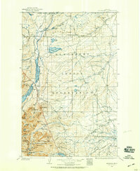
Other maps of this area
1901 · Browning
USGS Topo · 1:125,000
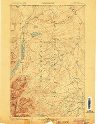
1903 · Browning
USGS Topo · 1:125,000

1904 · Chief Mountain
USGS Topo · 1:125,000
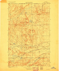
1911 · Blackfoot
USGS Topo · 1:125,000

1913 · Marias Pass
USGS Topo · 1:125,000

1914 · Nyack
USGS Topo · 1:125,000

1914 · Heart Butte
USGS Topo · 1:125,000
1918 · Heart Butte
USGS Topo · 1:125,000

1938 · Chief Mountain
USGS Topo · 1:125,000

1960 · Cut Bank
USGS Topo · 1:250,000