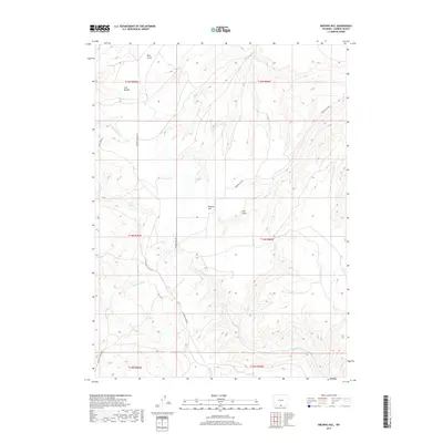
2017 Map of Browns Hill
USGS Topo · Published 2017About this map
Browns Hill rises as the central landmark in this 2017 survey of Wyoming's high-altitude drainage systems. The landscape is defined by an intricate network of seasonal and perennial waterways, including the southern reaches of S Fork Cherokee Cr and the branching paths of Loco Cr and W-Fork Loco Cr. This area is carved by numerous ravines such as Bird Gulch and Coal Gulch, which signal the complex erosional patterns typical of the region.
Find a feature on this map
20 named features on this map. Tap any name to fly to it.
Don’t see what you’re looking for? This feature index may not catch every label — zoom into the map to look around manually.
Map Details
Editions of this 2017 Browns Hill Map
This is the sole edition of this map. No revisions or reprints were ever made.
Other maps of this area

1932 · Savery
USGS Topo · 1:96,000

1940 · Savery
USGS Topo · 1:125,000

1954 · Rawlins
USGS Topo · 1:250,000

1957 · Baggs
USGS Topo · 1:62,500

1957 · Doty Mountain
USGS Topo · 1:62,500

1958 · Rawlins
USGS Topo · 1:250,000
1961 · Savery
USGS Topo · 1:24,000
1961 · Browns Hill
USGS Topo · 1:24,000

1961 · Ketchum Buttes
USGS Topo · 1:24,000

1961 · Grieve Reservoir
USGS Topo · 1:24,000