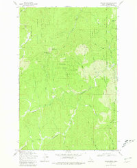
1969 Map of Browns Rock
USGS Topo · Published 1981About this map
Clearwater National Forest dominates this 1960s terrain, revealing a landscape defined by forestry and high-country exploration. Remote outposts like Camp 60 Lodge and the Washington Cabin are connected by a network of trails and an Old Railroad Grade that winds through the eastern ridges. The topography is anchored by prominent elevations including Deadhorse Mountain and Elk Mountain, where a Lookout Tower provides a strategic vantage point over the timberline.
Find a feature on this map
32 named features on this map. Tap any name to fly to it.
Don’t see what you’re looking for? This feature index may not catch every label — zoom into the map to look around manually.
Map Details
Editions of this 1969 Browns Rock Map
3 editions found
Other maps of this area

1923 · Washington Creek
USGS Topo · 1:125,000

1936 · Boehls Butte
USGS Topo · 1:48,000

1938 · Headquarters
USGS Topo · 1:48,000

1943 · Boehls Butte
USGS Topo · 1:62,500

1944 · Headquarters
USGS Topo · 1:62,500

1956 · Hamilton
USGS Topo · 1:250,000

1959 · Hamilton
USGS Topo · 1:250,000

1960 · Hamilton
USGS Topo · 1:250,000

1963 · Sheep Mtn
USGS Topo · 1:24,000

1963 · Clarke Mtn
USGS Topo · 1:24,000