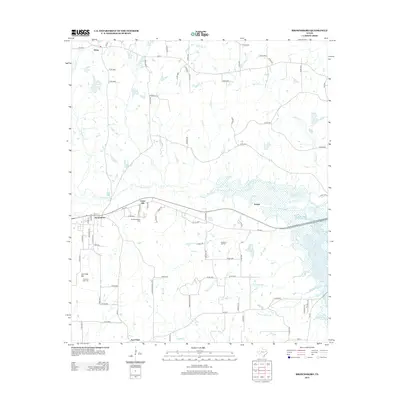
2013 Map of Brownsboro
USGS Topo · Published 2013About this map
Brownsboro serves as the central hub of this East Texas landscape, where the wooded terrain is defined by the extensive wetlands of Kickapoo Cr and the rising waters of Lake Palestine in the southeast. For those researching local family history, the map identifies several significant burial grounds, including the Old Norwegian Cem near Union Hill and the Old Rock Hill Cem situated further east. The topography is anchored by Jennings Mtn, with the corresponding Jennings Mtn Cem located at its base. Small rural settlements like Edom in the north and New Hope in the south are connected by a network of farm-to-market roads, while numerous tributaries such as Cottonwood Cr and Martin Spring Br drain the rolling countryside toward the lake basin.
Find a feature on this map
85 named features on this map. Tap any name to fly to it.
Don’t see what you’re looking for? This feature index may not catch every label — zoom into the map to look around manually.
Map Details
Editions of this 2013 Brownsboro Map
This is the sole edition of this map. No revisions or reprints were ever made.
Other maps of this area

1946 · Bullard
USGS Topo · 1:62,500

1948 · Bullard
USGS Topo · 1:62,500

1948 · Tyler
USGS Topo · 1:62,500

1948 · Brownsboro
USGS Topo · 1:62,500

1949 · Tyler
USGS Topo · 1:62,500

1949 · Brownsboro
USGS Topo · 1:62,500

1949 · Frankston
USGS Topo · 1:62,500

1950 · Frankston
USGS Topo · 1:62,500

1956 · Tyler
USGS Topo · 1:250,000

1966 · Chandler
USGS Topo · 1:24,000