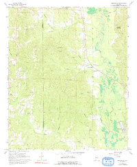
1967 Map of Brownville
USGS Topo · Published 1992About this map
The Sipsey River carves a winding path through the eastern half of this terrain, its broad floodplain contrasting with the high ridges of Phillips Mountain to the north. This 1960s landscape is defined by the intersection of rural community life and resource extraction, with Gravel Pits operating near the Pickens and Tuscaloosa county boundary. While the settlement at Brownville serves as a local anchor, the presence of an Old Railroad Grade running parallel to the river suggests a shift in the regional transport network, moving away from earlier industrial rail reliance toward the light-duty road system shown here. Scattered hilltop sites like Pleasant Ridge Ch and Spring Hill Ch reveal a settlement pattern tied to the high ground above the river valleys, where family-named sites such as Winn Cem and McGee Cem provide essential data points for local genealogy.
Find a feature on this map
33 named features on this map. Tap any name to fly to it.
Don’t see what you’re looking for? This feature index may not catch every label — zoom into the map to look around manually.
Map Details
Editions of this 1967 Brownville Map
2 editions found
Other maps of this area

1926 · Samantha
USGS Topo · 1:48,000

1928 · Samantha
USGS Topo · 1:62,500

1953 · Birmingham
USGS Topo · 1:250,000

1956 · Birmingham
USGS Topo · 1:250,000

1957 · Birmingham
USGS Topo · 1:250,000

1967 · Brownville
USGS Topo · 1:24,000

1967 · Newtonville
USGS Topo · 1:24,000

1967 · Kennedy
USGS Topo · 1:24,000

1967 · Gordo
USGS Topo · 1:24,000
1967 · Palmetto
USGS Topo · 1:24,000