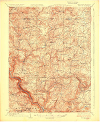
1926 Map of Bruceton
USGS Topo · Published 1926About this map
Big Sandy Creek winds through the heart of this Appalachian landscape, serving as the connective thread between industrial hubs like Bruceton Mills and Brandonville. The map reveals a highly decentralized rural society during the mid-1920s, defined by a dense network of one-room schoolhouses and country churches that anchored small farming hollows. Significant genealogical resources are scattered throughout, including the Old Brick Church and the Pleasant Grove Cem, alongside family-named educational sites like the Cuppett School and Glover School.
Find a feature on this map
95 named features on this map. Tap any name to fly to it.
Don’t see what you’re looking for? This feature index may not catch every label — zoom into the map to look around manually.
Map Details
Editions of this 1926 Bruceton Map
2 editions found

Other maps of this area

1886 · St. George
USGS Topo · 1:125,000

1891 · St. George
USGS Topo · 1:125,000

1895 · Piedmont
USGS Topo · 1:125,000

1899 · Oakland
USGS Topo · 1:62,500

1900 · Accident
USGS Topo · 1:62,500

1900 · Oakland
USGS Topo · 1:62,500

1900 · Uniontown
USGS Topo · 1:62,500

1900 · Masontown
USGS Topo · 1:62,500

1902 · Morgantown
USGS Topo · 1:62,500

1903 · Masontown
USGS Topo · 1:62,500