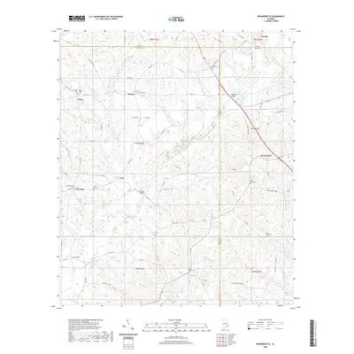
2020 Map of Brundidge SE
USGS Topo · Published 2020About this map
The Pea River carves a winding path through this corner of Southeast Alabama, where the borders of Pike, Coffee, and Dale Counties converge. This 2020 landscape is characterized by a series of small, established settlements like Roeton, Rocky Head, and Tennille, which are connected by a dense network of county roads. Genealogical interest is high throughout the quadrangle, with numerous family and community burial sites such as the Selgar Family Cem, New Tabernacle Cem, and the Saint Johns Cem marking the historical distribution of rural congregations. The topography is defined by numerous creek branches, including Huckleberry Cr and Beaverdam Cr, which feed into the larger river system. Significant river crossings like the Pea River Bridge and Johnsons Bridge remain vital landmarks, reflecting a long-standing reliance on these specific points for local transit between agricultural lands.
Find a feature on this map
85 named features on this map. Tap any name to fly to it.
Don’t see what you’re looking for? This feature index may not catch every label — zoom into the map to look around manually.
Map Details
Editions of this 2020 Brundidge SE Map
This is the sole edition of this map. No revisions or reprints were ever made.
Other maps of this area

1942 · Enterprise
USGS Topo · 1:125,000

1948 · Ozark
USGS Topo · 1:62,500

1948 · Brundidge
USGS Topo · 1:62,500

1950 · Ozark
USGS Topo · 1:62,500

1950 · Enterprise
USGS Topo · 1:62,500

1950 · Brundidge
USGS Topo · 1:62,500

1953 · Dothan
USGS Topo · 1:250,000

1954 · Dothan
USGS Topo · 1:250,000

1955 · Dothan
USGS Topo · 1:250,000

1960 · Brundidge
USGS Topo · 1:24,000