
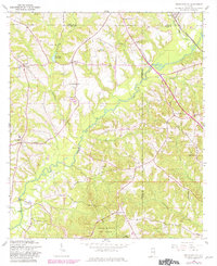
1960 Map of Brundidge SE
USGS Topo · Published 1963About this map
The Pea River snakes through the center of this rural landscape where Coffee, Pike, and Dale counties meet. This 1960 era survey reveals a countryside shaped by small crossroads settlements and the Atlantic Coast Line railroad corridor in the northeast near Tennille. Farming and timber dominate the economy, evidenced by the Prestwood Millpond on Clearwater Creek and numerous small country churches that served as community anchors, including Corinth Ch, New Salem Ch, and Pleasant Ridge Ch.
Find a feature on this map
36 named features on this map. Tap any name to fly to it.
Don’t see what you’re looking for? This feature index may not catch every label — zoom into the map to look around manually.
Map Details
Editions of this 1960 Brundidge SE Map
2 editions found
Other maps of this area

1942 · Enterprise
USGS Topo · 1:125,000

1948 · Ozark
USGS Topo · 1:62,500

1948 · Brundidge
USGS Topo · 1:62,500

1950 · Ozark
USGS Topo · 1:62,500

1950 · Enterprise
USGS Topo · 1:62,500

1950 · Brundidge
USGS Topo · 1:62,500

1953 · Dothan
USGS Topo · 1:250,000

1954 · Dothan
USGS Topo · 1:250,000

1955 · Dothan
USGS Topo · 1:250,000

1960 · Brundidge
USGS Topo · 1:24,000