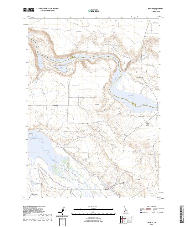
2024 Map of Bruneau
USGS Topo · Published 2024About this map
Bruneau stands at the junction of the desert and the irrigated Bruneau Valley, where the Bruneau River flows north toward its confluence with the Snake River. This high-desert landscape is defined by its water management and transit history, featuring the vast C J Strike Reservoir and its associated C J Strike Wildlife Management Area. The map documents a deep layer of western migration history, tracing the path of the Oregon Trail Rd and the Emigrant Trl across the arid flats. Genealogists will find the Bruneau Cem and the settlement of Sugar Valley in the southwest. The terrain is marked by distinct geological features like Wilkins Gulch and Crabb Butte, alongside human-engineered water systems such as the South Side Canal and Buckaroo Ditch that sustain local agriculture.
Find a feature on this map
42 named features on this map. Tap any name to fly to it.
Don’t see what you’re looking for? This feature index may not catch every label — zoom into the map to look around manually.
Map Details
Editions of this 2024 Bruneau Map
This is the sole edition of this map. No revisions or reprints were ever made.
Other maps of this area

1892 · Mountain Home
USGS Topo · 1:125,000

1893 · Mountain Home
USGS Topo · 1:125,000

1946 · Mouth of Bruneau
USGS Topo · 1:24,000

1947 · Little Valley
USGS Topo · 1:24,000

1947 · Bruneau
USGS Topo · 1:62,500

1947 · Sand Dunes
USGS Topo · 1:24,000

1947 · Bruneau
USGS Topo · 1:24,000

1947 · Sugar Valley
USGS Topo · 1:24,000

1947 · Hot Spring
USGS Topo · 1:24,000

1948 · Sand Dunes
USGS Topo · 1:24,000