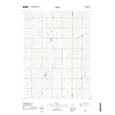
2017 Map of Bruno
USGS Topo · Published 2017About this map
Bruno and Abie anchor this section of the Butler and Saunders County line, where the agricultural grid meets the winding drainage of Skull Cr. The landscape is defined by its deep Catholic and Czech heritage, as seen in the numerous community landmarks like Saints Peter and Paul Cem and the two distinct locations labeled Bohemian Cem. These sites, along with Nimburg Cem and Saint Anthony Cem, offer critical data for genealogists tracing family roots in this corner of the Nebraska plains.
Find a feature on this map
58 named features on this map. Tap any name to fly to it.
Don’t see what you’re looking for? This feature index may not catch every label — zoom into the map to look around manually.
Map Details
Editions of this 2017 Bruno Map
This is the sole edition of this map. No revisions or reprints were ever made.
Other maps of this area
1899 · Wahoo
USGS Topo · 1:125,000
1899 · David City
USGS Topo · 1:125,000
1955 · Fremont
USGS Topo · 1:250,000
1957 · Fremont
USGS Topo · 1:250,000
1958 · Fremont
USGS Topo · 1:250,000
1965 · Brainard
USGS Topo · 1:24,000
1968 · Bruno
USGS Topo · 1:24,000
1968 · Schuyler
USGS Topo · 1:24,000
1968 · David City East
USGS Topo · 1:24,000
1968 · North Bend
USGS Topo · 1:24,000