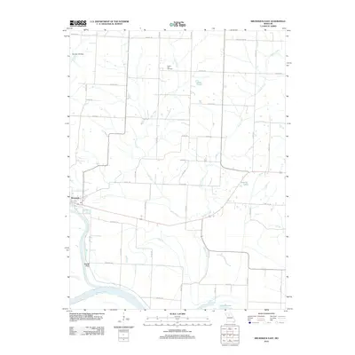
2012 Map of Brunswick East
USGS Topo · Published 2012About this map
Brunswick sits near the junction of major waterways in this section of Chariton County, where the Grand River flows into the Missouri River. The landscape is defined by the drainage patterns of Lake Creek and Palmer Creek, which wind through agricultural lands north of the river bottoms. This area reflects a long history of river-dependent settlement and commerce, evidenced by the riverfront location of Grand Port and the presence of several oxbow-style water bodies such as Cut-Off Lake and Agee Lake. Rural life is anchored by family-named sites and local landmarks like the Prairie Dell Cemetery and the Number 275 Dam. The road network, including Keelboat Rd and Boatman Rd, hints at the deep maritime and riverine heritage that once dominated this Missouri valley corridor.
Find a feature on this map
26 named features on this map. Tap any name to fly to it.
Don’t see what you’re looking for? This feature index may not catch every label — zoom into the map to look around manually.
Map Details
Editions of this 2012 Brunswick East Map
This is the sole edition of this map. No revisions or reprints were ever made.
Other maps of this area

1890 · Glasgow
USGS Topo · 1:125,000

1890 · Marshall
USGS Topo · 1:125,000

1892 · Marshall
USGS Topo · 1:125,000

1901 · Marshall
USGS Topo · 1:125,000

1949 · Mendon
USGS Topo · 1:24,000

1949 · Indian Grove
USGS Topo · 1:24,000

1951 · Miami
USGS Topo · 1:24,000

1951 · Brunswick West
USGS Topo · 1:24,000

1951 · Brunswick East
USGS Topo · 1:24,000
1951 · New Frankfort
USGS Topo · 1:24,000