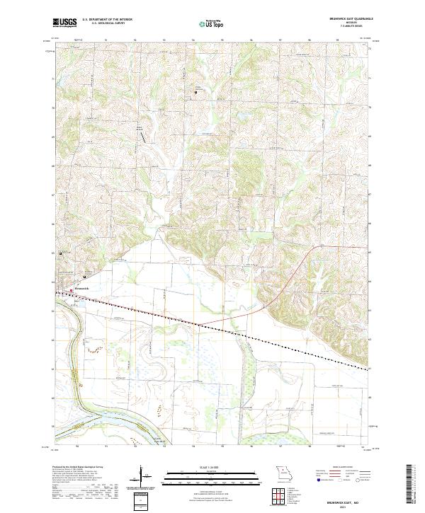
2021 Map of Brunswick East
USGS Topo · Published 2021About this map
Brunswick serves as the focal point of this riverfront landscape, situated where the northern hills descend toward the expansive floodplains of the Missouri River. The area is characterized by a transition from the rolling agricultural uplands, dotted with family and community burial grounds such as Prairie Dell Cem and Elliott Grove Cem, to the low-lying wetlands and backwaters near Grand River Bend. The land use reflects a mix of modern infrastructure and rural tradition, with the Shiloh Airpark situated among upland roads like Iowas Rd and York Rd. Water management is evident throughout the terrain, from the winding paths of Lake Cr and Palmer Cr to named bodies like Agee Lake and Reische Lake, which suggest the historic shifting of river channels and the engineering required to stabilize this fertile bottomland.
Find a feature on this map
44 named features on this map. Tap any name to fly to it.
Don’t see what you’re looking for? This feature index may not catch every label — zoom into the map to look around manually.
Map Details
Editions of this 2021 Brunswick East Map
This is the sole edition of this map. No revisions or reprints were ever made.
Other maps of this area

1890 · Glasgow
USGS Topo · 1:125,000

1890 · Marshall
USGS Topo · 1:125,000

1892 · Marshall
USGS Topo · 1:125,000

1901 · Marshall
USGS Topo · 1:125,000

1949 · Mendon
USGS Topo · 1:24,000

1949 · Indian Grove
USGS Topo · 1:24,000

1951 · Miami
USGS Topo · 1:24,000

1951 · Brunswick West
USGS Topo · 1:24,000

1951 · Brunswick East
USGS Topo · 1:24,000
1951 · New Frankfort
USGS Topo · 1:24,000