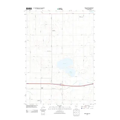
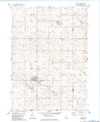
2013 Map of Brush Creek
USGS Topo · Published 2013About this map
Brush Creek anchors this Faribault County landscape, situated near the intersection of Co Hwy-21 and 115th St. The area's agricultural history is reflected in the numerous burial grounds that dot the section lines, including the Walnut Lake Methodist Cem, Walnut Lake Cem, and the N Blue Earth Lutheran Cem. The terrain is defined by its water management and natural hydrology, from the prominent Walnut Lake and South Walnut Lake to the meandering E Br Blue Earth River and Foster Cr. Modern infrastructure is represented by the Wells Municipal Airport in the northern portion of the quadrangle and the engineered flow of County Ditch Number Thirtyseven. This map illustrates the intersection of mid-century aviation, local religious history, and the persistent water systems of southern Minnesota.
Find a feature on this map
26 named features on this map. Tap any name to fly to it.
Don’t see what you’re looking for? This feature index may not catch every label — zoom into the map to look around manually.
Map Details
Editions of this 2013 Brush Creek Map
This is the sole edition of this map. No revisions or reprints were ever made.
Other maps of this area

1954 · Mason City
USGS Topo · 1:250,000

1955 · Bricelyn
USGS Topo · 1:62,500

1955 · Wells
USGS Topo · 1:62,500

1957 · Mason City
USGS Topo · 1:250,000

1958 · Mason City
USGS Topo · 1:250,000

1967 · Minnesota Lake
USGS Topo · 1:24,000
1967 · Matawan
USGS Topo · 1:24,000
1967 · Easton
USGS Topo · 1:24,000
1982 · Bricelyn
USGS Topo · 1:24,000
1982 · Kiester
USGS Topo · 1:24,000