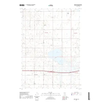
2019 Map of Brush Creek
USGS Topo · Published 2019About this map
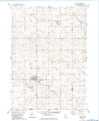
The agrarian landscape of Faribault County is dominated by the waters of Walnut Lake and South Walnut Lake, which serve as central geographic anchors for this rural region. The settlement of Brush Creek sits along a grid of section-line roads, such as Co Rd 16 and Co Rd 21, which weave through productive prairie land. The drainage of the area is further defined by the E Br Blue Earth River and Foster Cr, carving through the southern and eastern portions of the township. For those researching local history or genealogy, several small burial grounds are meticulously documented, including Walnut Lake Methodist Cem and the North Blue Earth Lutheran Cem. The presence of the Wells Municipal Airport in the northern section indicates the transition toward more modern infrastructure while maintaining the area’s longstanding commitment to its agricultural and water-based geography.
Find a feature on this map
38 named features on this map. Tap any name to fly to it.
Don’t see what you’re looking for? This feature index may not catch every label — zoom into the map to look around manually.
Map Details
Editions of this 2019 Brush Creek Map
This is the sole edition of this map. No revisions or reprints were ever made.
Other maps of this area

1954 · Mason City
USGS Topo · 1:250,000

1955 · Bricelyn
USGS Topo · 1:62,500

1955 · Wells
USGS Topo · 1:62,500

1957 · Mason City
USGS Topo · 1:250,000

1958 · Mason City
USGS Topo · 1:250,000

1967 · Minnesota Lake
USGS Topo · 1:24,000
1967 · Matawan
USGS Topo · 1:24,000
1967 · Easton
USGS Topo · 1:24,000
1982 · Bricelyn
USGS Topo · 1:24,000
1982 · Kiester
USGS Topo · 1:24,000