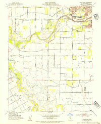
1953 Map of Brush Lake
USGS Topo · Published 1954About this map
The confluence of the Tuolumne River and the San Joaquin River dominates this mid-century portrait of the Central Valley. The landscape is a detailed grid of agricultural development, defined by an intricate network of lateral canals and irrigation drains such as the Westport Drain. This era shows the expansion of Modesto southwest of its city boundary, where residential blocks and schools like Burbank Sch and James Marshall Sch begin to replace the open fields of the historical Rancho Del Puerto land grant.
Find a feature on this map
63 named features on this map. Tap any name to fly to it.
Don’t see what you’re looking for? This feature index may not catch every label — zoom into the map to look around manually.
Map Details
Editions of this 1953 Brush Lake Map
2 editions found
Other maps of this area

1915 · Ripon
USGS Topo · 1:31,680

1915 · Westport
USGS Topo · 1:31,680

1915 · Westley
USGS Topo · 1:31,680

1915 · Salida
USGS Topo · 1:31,680

1916 · Mitchell School
USGS Topo · 1:31,680

1916 · Crows Landing
USGS Topo · 1:31,680

1916 · Patterson
USGS Topo · 1:31,680

1916 · Riverbank
USGS Topo · 1:31,680

1916 · Ceres
USGS Topo · 1:31,680

1919 · Orestimba
USGS Topo · 1:62,500