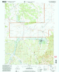
2002 Map of Bryce Canyon
USGS Topo · Published 2005About this map
Bryce Canyon and the Pink Cliffs dominate this landscape, where the high desert terrain transitions into intricate geologic formations. The area's mid-century tourism infrastructure is centered around Rubys Inn and the Bryce Canyon settlement, supported by the Bryce Canyon Airport in Johns Valley. The map highlights the interplay between protected lands and working landscapes, from the managed timber of the Dixie National Forest to the specialized preservation within Bryce Canyon National Park.
Find a feature on this map
60 named features on this map. Tap any name to fly to it.
Don’t see what you’re looking for? This feature index may not catch every label — zoom into the map to look around manually.
Map Details
Editions of this 2002 Bryce Canyon Map
This is the sole edition of this map. No revisions or reprints were ever made.
Other maps of this area

1886 · Kanab
USGS Topo · 1:250,000

1953 · Cedar City
USGS Topo · 1:250,000

1958 · Cedar City
USGS Topo · 1:250,000

1962 · Cedar City
USGS Topo · 1:250,000
1966 · Cannonville
USGS Topo · 1:24,000

1966 · Wilson Peak
USGS Topo · 1:24,000
1966 · Bryce Canyon
USGS Topo · 1:24,000
1966 · Tropic Canyon
USGS Topo · 1:24,000
1966 · Tropic Reservoir
USGS Topo · 1:24,000
1966 · Bryce Point
USGS Topo · 1:24,000