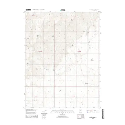
2014 Map of Bryson Canyon
USGS Topo · Published 2014About this map
The energy-rich landscape of Grand County is dominated by the Bryson Canyon Gas Field and the Stateline Gas Field, highlighting the modern industrial character of this high-desert terrain. These natural resource developments sit among a complex geography of ridges and canyons, including the prominent Book Cliffs and San Arroyo Ridge. The drainage patterns are defined by seasonal and perennial watercourses such as Bitter Cr and Westwater Cr, which have carved deep features like Trap Canyon and San Arroyo Canyon over millennia. Landmarks like Hat Rock and Lion Bench provide essential orientation in a region where the topography transitions from high plateaus to the winding San Arroyo Wash. This 2014 survey documents the intersection of geology and industry, showing how infrastructure for the Bar X Gas Field navigates the challenging elevation changes of the Bryson Ridge.
Find a feature on this map
25 named features on this map. Tap any name to fly to it.
Don’t see what you’re looking for? This feature index may not catch every label — zoom into the map to look around manually.
Map Details
Editions of this 2014 Bryson Canyon Map
This is the sole edition of this map. No revisions or reprints were ever made.
Other maps of this area
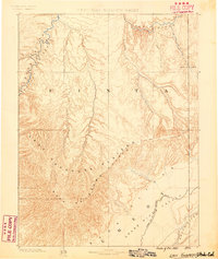
1885 · East Tavaputs
USGS Topo · 1:250,000

1956 · Grand Junction
USGS Topo · 1:250,000

1959 · Grand Junction
USGS Topo · 1:250,000

1960 · Grand Junction
USGS Topo · 1:250,000
1962 · Grand Junction
USGS Topo · 1:250,000
1964 · Grand Junction
USGS Topo · 1:250,000
1965 · Grand Junction
USGS Topo · 1:250,000
1970 · Harley Dome
USGS Topo · 1:24,000
1970 · Bar X Wash
USGS Topo · 1:24,000
1970 · Bitter Creek Well
USGS Topo · 1:24,000