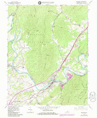
1961 Map of Buchanan
USGS Topo · Published 1985About this map
The town of Buchanan serves as the focal point of this Virginia survey, situated where the James River makes a sharp southward bend between Purgatory Mountain and Cove Mountain. This 1960s landscape, updated with mid-1980s developments, reveals a corridor defined by heavy transit and industry, including the Norfolk and Western and Chesapeake and Ohio railroads. The town’s layout is punctuated by its Gaging Sta and Fairview Cemetery, while the surrounding terrain is marked by significant landmarks like Saltpetre Cave and The Gorge.
Find a feature on this map
68 named features on this map. Tap any name to fly to it.
Don’t see what you’re looking for? This feature index may not catch every label — zoom into the map to look around manually.
Map Details
Editions of this 1961 Buchanan Map
3 editions found
Other maps of this area

1890 · Roanoke
USGS Topo · 1:125,000

1891 · Roanoke
USGS Topo · 1:125,000

1894 · Natural Bridge
USGS Topo · 1:125,000

1894 · Natural Bridge
USGS Topo · 1:62,500

1907 · Natural Bridge Special
USGS Topo · 1:62,500

1913 · Eagle Rock
USGS Topo · 1:48,000

1915 · Eagle Rock
USGS Topo · 1:62,500

1929 · Roanoke
USGS Topo · 1:48,000

1933 · Roanoke
USGS Topo · 1:62,500

1947 · Roanoke
USGS Topo · 1:250,000