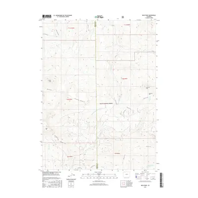
2016 Map of Buck Point
USGS Topo · Published 2016About this map
The high-altitude drainage basins of Routt National Forest define this landscape along the boundary of Routt and Moffat counties. Centered on high points like Buck Point, Sawtooth Mtn, and Black Mtn, the terrain is etched by a complex network of headwaters including Boulder Cr, Slater Cr, and the S Fork Slater Cr. These waterways flow through a rugged interior accessible primarily by a historical system of paths and tracks. Long-established routes such as the Bears Ears Trail, Lost Park Trail, and Black Mountain Trail indicate a long history of high-country transit, likely used for seasonal livestock grazing or hunting. The map also captures the transition from open range at Sawtooth Park to the timbered slopes accessed via the Routt Forest Loop, providing a clear view of the forest management and resource patterns in the mid-2010s.
Find a feature on this map
33 named features on this map. Tap any name to fly to it.
Don’t see what you’re looking for? This feature index may not catch every label — zoom into the map to look around manually.
Map Details
Editions of this 2016 Buck Point Map
This is the sole edition of this map. No revisions or reprints were ever made.
Other maps of this area

1923 · Elkhead Creek
USGS Topo · 1:62,500

1923 · Pilot Knob
USGS Topo · 1:62,500

1924 · Elkhead Creek
USGS Topo · 1:62,500

1925 · Pilot Knob
USGS Topo · 1:62,500

1954 · Craig
USGS Topo · 1:250,000

1957 · Craig
USGS Topo · 1:250,000

1958 · Craig
USGS Topo · 1:250,000

1960 · Craig
USGS Topo · 1:250,000

1962 · Craig
USGS Topo · 1:250,000
1962 · Tumble Mountain
USGS Topo · 1:24,000