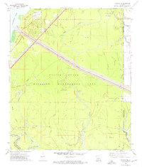
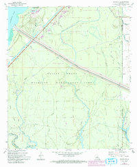
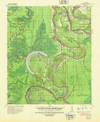
1972 Map of Buckeye NE
USGS Topo · Published 1974About this map
Saline State Wildlife Management Area dominates this central Louisiana landscape, where the shifting hydrology of the Mississippi alluvial plain meets active petroleum extraction. The 1970s terrain is defined by a dense network of waterways including Indian Bayou, Muddy Bayou, and the Catahoula Lake Diversion Canal, which is flanked by a significant Levee system. This infrastructure reflects decades of flood control efforts designed to manage the seasonal fluctuations of Catahoula Lake and Saline Lake.
Find a feature on this map
41 named features on this map. Tap any name to fly to it.
Don’t see what you’re looking for? This feature index may not catch every label — zoom into the map to look around manually.
Map Details
Editions of this 1972 Buckeye NE Map
2 editions found
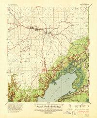
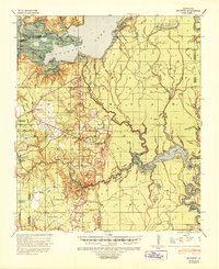
Other maps of this area

1935 · Tooleys
USGS Topo · 1:62,500

1941 · Manifest
USGS Topo · 1:62,500
1941 · Jena
USGS Topo · 1:62,500
1941 · Buckeye
USGS Topo · 1:62,500
1941 · Tooleys
USGS Topo · 1:62,500

1953 · Alexandria
USGS Topo · 1:250,000

1953 · Natchez
USGS Topo · 1:250,000

1955 · Alexandria
USGS Topo · 1:250,000

1956 · Natchez
USGS Topo · 1:250,000
1958 · Jena
USGS Topo · 1:62,500