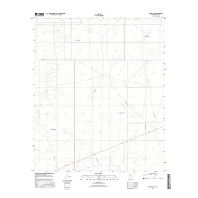
2017 Map of Buckeye NW
USGS Topo · Published 2017About this map
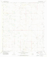
Martin Ranch Rd and Patterson Rd traverse this high plains landscape in the northwestern portion of the Buckeye quadrangle. Located in Lea County, the area is defined by a sparse network of county roads and ranch access routes that suggest a remote pastoral and industrial character common to southeastern New Mexico. The land is organized by the Public Land Survey System, with township boundaries for t15s r32e, t15s r33e, t16s r32e, and t16s r33e meeting at a central point. While largely open, the terrain is marked by seasonal basins and specialized tracks like Natural Rd and Andromeda Ln, which likely serve local agricultural or resource extraction interests. Other key corridors include Wilbanks Rd in the northwest and various county routes such as Co Rd 118 and Co Rd 121, providing a detailed look at the rural infrastructure of this Llano Estacado region in the early 21st century.
Find a feature on this map
12 named features on this map. Tap any name to fly to it.
Don’t see what you’re looking for? This feature index may not catch every label — zoom into the map to look around manually.
Map Details
Editions of this 2017 Buckeye NW Map
This is the sole edition of this map. No revisions or reprints were ever made.
Other maps of this area

1954 · Hobbs
USGS Topo · 1:250,000

1954 · Brownfield
USGS Topo · 1:250,000

1958 · Brownfield
USGS Topo · 1:250,000

1958 · Hobbs
USGS Topo · 1:250,000

1962 · Brownfield
USGS Topo · 1:250,000
1962 · Buckeye
USGS Topo · 1:62,500
1963 · Maljamar
USGS Topo · 1:62,500
1973 · Fort Ranch
USGS Topo · 1:24,000
1973 · Dean Ranch
USGS Topo · 1:24,000
1973 · Cedar Point SE
USGS Topo · 1:24,000