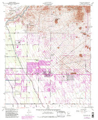
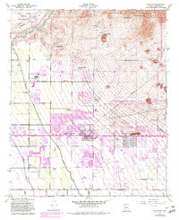
1956 Map of Buckhorn
USGS Topo · Published 1983About this map
Salt River Indian Reservation and the Tonto National Forest define the northern limits of this landscape, where the Salt River flows past the Usery Mts. This 1956 map, updated with 1980s urban expansion, documents the rapid transformation of the desert floor into a grid of residential developments and irrigation infrastructure. The South Canal, Roosevelt Canal, and Consolidated Canal weave through the terrain, supporting the agricultural transition of areas like Sunshine Acres and Harmony Villa. Notable aviation history is represented by Falcon Field, while local social landmarks including the Arizona Girls Ranch and the Spook Hill Recreation Area provide a sense of the community's mid-century footprint. The expansion of Mesa is clearly visible through purple-tinted urban updates, showing how new neighborhoods pushed toward the Double Knolls and the base of Stone Mth.
Find a feature on this map
39 named features on this map. Tap any name to fly to it.
Don’t see what you’re looking for? This feature index may not catch every label — zoom into the map to look around manually.
Map Details
Editions of this 1956 Buckhorn Map
5 editions found
Other maps of this area

1904 · Camelback
USGS Topo · 1:62,500

1904 · Desert Well
USGS Topo · 1:62,500

1904 · Ft. McDowell
USGS Topo · 1:62,500

1906 · Camelsback
USGS Topo · 1:62,500

1906 · Ft. McDowell
USGS Topo · 1:62,500

1906 · Desert Well
USGS Topo · 1:62,500

1913 · Mesa
USGS Topo · 1:62,500

1915 · Mesa
USGS Topo · 1:62,500

1930 · Cave Creek
USGS Topo · 1:125,000

1939 · Cave Creek
USGS Topo · 1:125,000