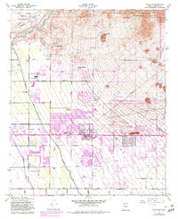
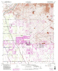
1956 Map of Buckhorn
USGS Topo · Published 1983About this map
Falcon Field and the surrounding desert landscape north of Mesa are captured in this mid-century survey, which reveals the transition from open ranch land to residential developments. The map illustrates a complex network of irrigation and water management, featuring the Salt River, the Southern Canal, and the Roosevelt Canal. These lifelines supported early communities such as Sunshine Acres and Buckhorn, located along the historic Apache Trail.
Find a feature on this map
32 named features on this map. Tap any name to fly to it.
Don’t see what you’re looking for? This feature index may not catch every label — zoom into the map to look around manually.
Map Details
Editions of this 1956 Buckhorn Map
5 editions found
Other maps of this area

1904 · Camelback
USGS Topo · 1:62,500

1904 · Desert Well
USGS Topo · 1:62,500

1904 · Ft. McDowell
USGS Topo · 1:62,500

1906 · Camelsback
USGS Topo · 1:62,500

1906 · Ft. McDowell
USGS Topo · 1:62,500

1906 · Desert Well
USGS Topo · 1:62,500

1913 · Mesa
USGS Topo · 1:62,500

1915 · Mesa
USGS Topo · 1:62,500

1930 · Cave Creek
USGS Topo · 1:125,000

1939 · Cave Creek
USGS Topo · 1:125,000