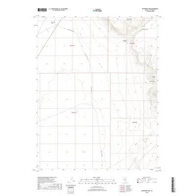
2018 Map of Buckwheat Rim
USGS Topo · Published 2018About this map
Hot Creek Valley defines the western expanse of this high-desert landscape in Nye County, where the seasonal waters of Hot Cr thread across the valley floor. The geography is dominated by the sharp elevation gains of the Pancake Range to the east, culminating in landmarks like Buckskin Point and the namesake Buckwheat Rim. The structural geology of the region is evident in features such as Palisade Mesa and the winding Monocline Canyon. Human presence is represented primarily by the Twin Springs Ranch Rd, which serves as the principal corridor through this arid basin, connecting the isolated ranching interests and grazing lands that characterize this part of Nevada.
Find a feature on this map
12 named features on this map. Tap any name to fly to it.
Don’t see what you’re looking for? This feature index may not catch every label — zoom into the map to look around manually.
Map Details
Editions of this 2018 Buckwheat Rim Map
This is the sole edition of this map. No revisions or reprints were ever made.
Other maps of this area

1956 · Tonopah
USGS Topo · 1:250,000

1959 · Tonopah
USGS Topo · 1:250,000

1962 · Tonopah
USGS Topo · 1:250,000

1967 · Lunar Crater
USGS Topo · 1:62,500

1967 · Blue Jay Spring
USGS Topo · 1:24,000

1967 · Buckwheat Rim
USGS Topo · 1:24,000

1967 · Palisade Mesa
USGS Topo · 1:24,000

1967 · Lunar Crater
USGS Topo · 1:24,000
1967 · Chuck Wagon Flat
USGS Topo · 1:24,000

1967 · Tybo SE
USGS Topo · 1:24,000