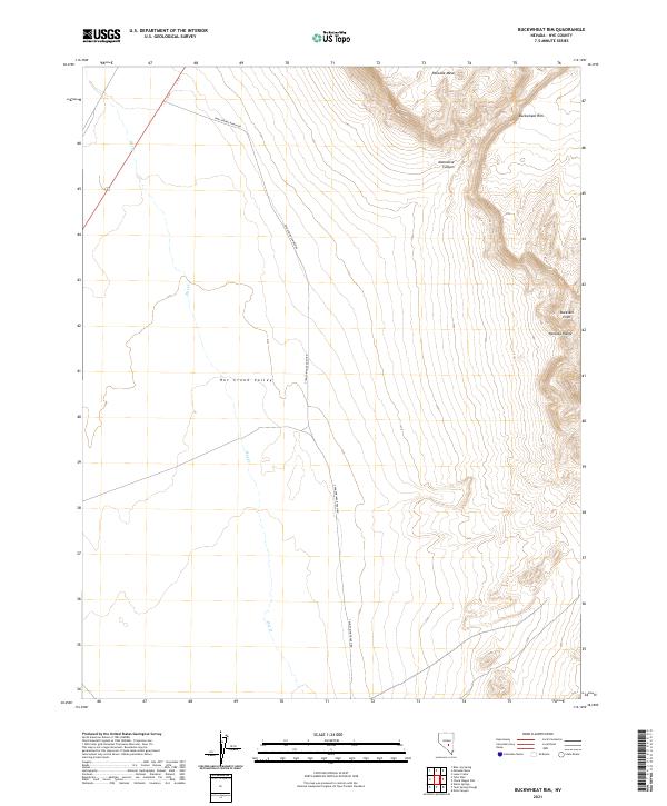
2021 Map of Buckwheat Rim
USGS Topo · Published 2021About this map
Hot Creek Valley dominates this high-desert landscape in central Nevada, providing a broad basin that contrasts with the rising elevations of the Pancake Range to the east. This 2021 survey illustrates a sparsely developed terrain defined by volcanic and sedimentary landforms, such as the prominent Palisade Mesa and the sharp drop-offs of the Buckwheat Rim. The drainage of Hot Cr meanders through the valley floor, a vital water source in an otherwise arid environment.
Find a feature on this map
12 named features on this map. Tap any name to fly to it.
Don’t see what you’re looking for? This feature index may not catch every label — zoom into the map to look around manually.
Map Details
Editions of this 2021 Buckwheat Rim Map
This is the sole edition of this map. No revisions or reprints were ever made.
Other maps of this area

1956 · Tonopah
USGS Topo · 1:250,000

1959 · Tonopah
USGS Topo · 1:250,000

1962 · Tonopah
USGS Topo · 1:250,000

1967 · Lunar Crater
USGS Topo · 1:62,500

1967 · Blue Jay Spring
USGS Topo · 1:24,000

1967 · Buckwheat Rim
USGS Topo · 1:24,000

1967 · Palisade Mesa
USGS Topo · 1:24,000

1967 · Lunar Crater
USGS Topo · 1:24,000
1967 · Chuck Wagon Flat
USGS Topo · 1:24,000

1967 · Tybo SE
USGS Topo · 1:24,000