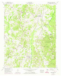
1950 Map of Buena Vista
USGS Topo · Published 1974About this map
The Tennessee Valley Divide snakes through this Carroll County landscape, separating the intricate drainage networks that define local settlement patterns. In the mid-century era, the small community of Westport serves as a central point along the Louisville and Nashville railroad, surrounded by family-named landmarks and rural congregations like Williams Chapel and Mud Creek Church. The eastern portion of the map is dominated by the dense woodlands of the Natchez Trace State Park and Forest, where the terrain drops toward the Big Sandy River Drainage Canal. Systematic water management is evident throughout the region, seen in the engineered paths of the Bacon Drainage Canal and Beaver Creek Drainage Canal, which were designed to reclaim the low-lying bottomlands of Goose Pond Swamp and Bradford Swamp for agricultural use.
Find a feature on this map
54 named features on this map. Tap any name to fly to it.
Don’t see what you’re looking for? This feature index may not catch every label — zoom into the map to look around manually.
Map Details
Editions of this 1950 Buena Vista Map
3 editions found
Other maps of this area

1936 · Clarksburg
USGS Topo · 1:24,000

1936 · Yuma
USGS Topo · 1:24,000

1936 · Seventeen Creek
USGS Topo · 1:24,000

1936 · Vale
USGS Topo · 1:24,000

1936 · Center Ridge
USGS Topo · 1:24,000

1936 · Bruceton
USGS Topo · 1:24,000

1936 · Cavvia
USGS Topo · 1:24,000

1936 · Buena Vista
USGS Topo · 1:24,000

1950 · Yuma
USGS Topo · 1:24,000

1950 · Palmer Shelter
USGS Topo · 1:24,000