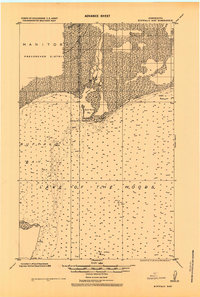
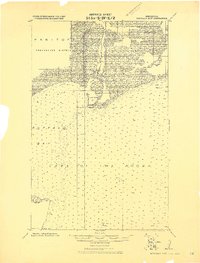
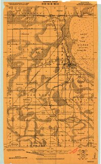
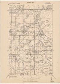
1918 Map of Buffalo Bay
USGS Topo · Published 1924About this map
Buffalo Bay and the international waters of Lake of the Woods define this borderland survey, which documents the northernmost reaches of Minnesota where it meets the Manitoba province. The landscape is dominated by the hydrology of the lake, with extensive soundings recorded across the bay and around prominent landforms like Buffalo Point and Stoney Point. The boundary line between the United States and Canada is clearly delineated as it cuts through the marshy terrain of the Provencher District. Survey markers like U.S.&C.B.S. Stoney and U.S.&C.B.S. Jinx pinpoint the precise locations used by the Corps of Engineers to establish the topography of this remote shoreline. The map illustrates a world of mud, clay, and sand along the mouth of Stoney Creek, capturing the wilderness character of the region before significant modern development.
Find a feature on this map
15 named features on this map. Tap any name to fly to it.
Don’t see what you’re looking for? This feature index may not catch every label — zoom into the map to look around manually.
Map Details
Editions of this 1918 Buffalo Bay Map
2 editions found
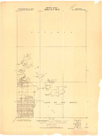
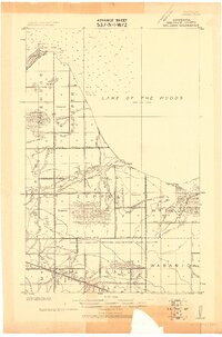
Other maps of this area
1918 · Buffalo Bay
USGS Topo · 1:62,500

1918 · Roosevelt
USGS Topo · 1:62,500
1918 · Oak Island
USGS Topo · 1:62,500
1918 · Williams
USGS Topo · 1:62,500
1918 · Warroad
USGS Topo · 1:62,500

1943 · Roosevelt
USGS Topo · 1:62,500
1943 · Warroad
USGS Topo · 1:62,500

1954 · Roseau
USGS Topo · 1:250,000

1957 · Roseau
USGS Topo · 1:250,000

1958 · Roseau
USGS Topo · 1:250,000