
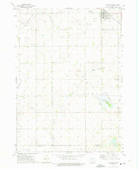
1972 Map of Buffalo Center NE
USGS Topo · Published 1975About this map
The town of Thompson anchors the southern portion of this northern Iowa survey, situated along the Chicago Rock Island and Pacific railroad line. This agricultural landscape in Winnebago County is defined by the intersection of several townships, including Lincoln, Eden, Buffalo, and King. The map captures a moment when local infrastructure included the Halverson Landing Strip and small community spaces like Florence Park.
Find a feature on this map
16 named features on this map. Tap any name to fly to it.
Don’t see what you’re looking for? This feature index may not catch every label — zoom into the map to look around manually.
Map Details
Editions of this 1972 Buffalo Center NE Map
This is the sole edition of this map. No revisions or reprints were ever made.
Other maps of this area

1954 · Mason City
USGS Topo · 1:250,000

1955 · Bricelyn
USGS Topo · 1:62,500

1955 · Wells
USGS Topo · 1:62,500

1957 · Mason City
USGS Topo · 1:250,000

1958 · Mason City
USGS Topo · 1:250,000

1972 · Buffalo Center
USGS Topo · 1:24,000

1972 · Buffalo Center SW
USGS Topo · 1:24,000

1972 · Forest City
USGS Topo · 1:24,000

1972 · Vinje
USGS Topo · 1:24,000
1972 · Thompson
USGS Topo · 1:24,000