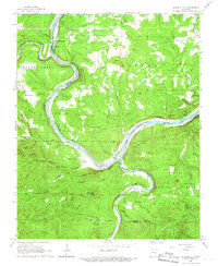
1966 Map of Buffalo City
USGS Topo · Published 1967About this map
The confluence of the Buffalo River and the White River dominates this mid-1960s landscape at the boundary of Marion and Baxter counties. This era shows the active presence of the Missouri Pacific railroad tracing the river bends, serving local points like Buffalo City (Buffalo Sta) and Buford Station. The rugged interior is marked by significant topographical landmarks such as Prince Fred Knob, Warrior Creek Mountain, and Hip Mountain, reflecting a geography that dictated the winding paths of roads and rails alike.
Find a feature on this map
58 named features on this map. Tap any name to fly to it.
Don’t see what you’re looking for? This feature index may not catch every label — zoom into the map to look around manually.
Map Details
Editions of this 1966 Buffalo City Map
3 editions found
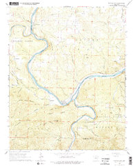
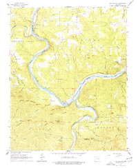
Other maps of this area

1890 · Mountain Home
USGS Topo · 1:125,000

1891 · Mountain Home
USGS Topo · 1:125,000

1893 · Yellville
USGS Topo · 1:125,000

1894 · Mountain Home
USGS Topo · 1:125,000

1903 · Yellville
USGS Topo · 1:125,000

1905 · Yellville
USGS Topo · 1:125,000

1929 · Yellville
USGS Topo · 1:125,000

1945 · Harrison
USGS Topo · 1:250,000

1949 · Harrison
USGS Topo · 1:250,000

1954 · Harrison
USGS Topo · 1:250,000