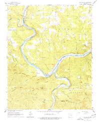
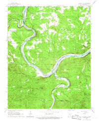
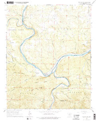
1966 Map of Buffalo City
USGS Topo · Published 1977About this map
The confluence of the White River and the Buffalo River serves as the focal point of this mid-1960s landscape, marking the rugged boundary between Marion and Baxter counties. The Missouri Pacific railroad snakes along the northern bank of the White River, connecting small settlements and transit points like Cartney and Buford Station. The map illustrates a transitional period where historic river hubs were being superseded by rail and road networks, with Buffalo City and nearby Old Buffalo positioned at the river bend.
Find a feature on this map
63 named features on this map. Tap any name to fly to it.
Don’t see what you’re looking for? This feature index may not catch every label — zoom into the map to look around manually.
Map Details
Editions of this 1966 Buffalo City Map
3 editions found
Other maps of this area

1890 · Mountain Home
USGS Topo · 1:125,000

1891 · Mountain Home
USGS Topo · 1:125,000

1893 · Yellville
USGS Topo · 1:125,000

1894 · Mountain Home
USGS Topo · 1:125,000

1903 · Yellville
USGS Topo · 1:125,000

1905 · Yellville
USGS Topo · 1:125,000

1929 · Yellville
USGS Topo · 1:125,000

1945 · Harrison
USGS Topo · 1:250,000

1949 · Harrison
USGS Topo · 1:250,000

1954 · Harrison
USGS Topo · 1:250,000