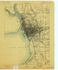
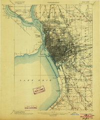
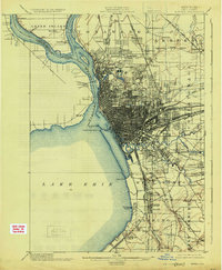
1901 Map of Buffalo
USGS Topo · Published 1901About this map
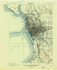
The dense industrial and rail grid of Buffalo dominates the eastern shore of the Niagara River in this 1901 survey. The city's growth is clearly illustrated by the extensive Belt Line and a massive concentration of rail infrastructure, including the New York Central and Hudson River R.R. and the Erie R.R. yards. To the west, across the United States Dominion of Canada border, the Fort Erie (Ruins) stand as a landmark of earlier frontier history, while the International Bridge provides a modern transit link. Beyond the urban core, the map captures suburban development in Kenmore, Cheektowaga, and Amherst. Navigational aids like the Buffalo L.H. and the Buffalo Breakwater L.H. mark the entrance to Lake Erie, highlighting the city's role as a vital Great Lakes port at the turn of the century.
Find a feature on this map
84 named features on this map. Tap any name to fly to it.
Don’t see what you’re looking for? This feature index may not catch every label — zoom into the map to look around manually.
Map Details
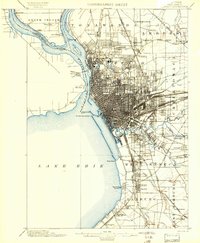
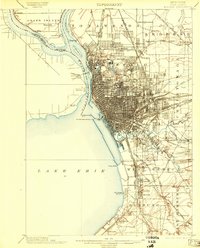
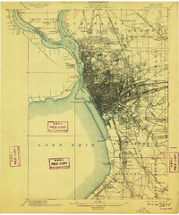
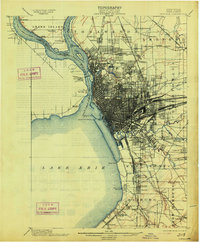
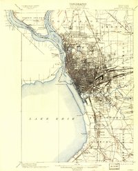
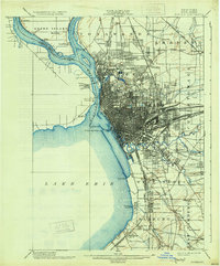
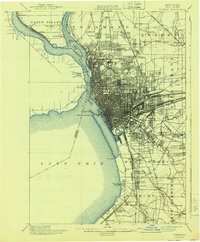
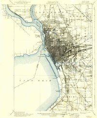
Editions of this 1901 Buffalo Map
12 editions found

1901 edition
16.5 x 19.7 inches
1901 edition
15.99 x 19.39 inches
1903 edition
15.49 x 19.18 inches
1903 edition
16.5 x 19.9 inches
1909 edition
16.5 x 19.9 inches
1913 edition
16.5 x 20 inches
1913 edition
15.91 x 19.69 inches
1925 edition
16.4 x 19.9 inches
1931 edition
16.6 x 20 inches
1940 edition
16.5 x 19.9 inches
1940 edition
15.99 x 19.41 inches
1947 edition
17.1 x 20.9 inches
Historical Maps of Buffalo Through Time
8 maps found