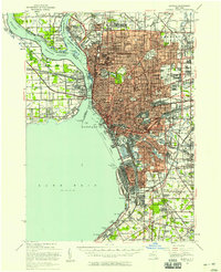
1948 Map of Buffalo
USGS Topo · Published 1958About this map
Buffalo Harbor serves as the focal point for this post-war landscape, where the heavy industrial infrastructure of Lackawanna meets the expanding residential suburbs of Cheektowaga and Kenmore. The map documents a critical period of international connectivity, featuring the Peace Bridge Toll and the Skyway alongside a dense network of rail lines including the New York Central and Lehigh Valley. On the Canadian side of the Niagara River, the grid of Fort Erie and Frenchmans is clearly delineated within the Welland District. Local heritage is preserved through the naming of numerous institutions like Bennett High Sch and Canisius High Sch, while large municipal green spaces such as Delaware Park and the Zoo contrast with the industrial zones and extensive rail yards that fueled the regional economy.
Find a feature on this map
93 named features on this map. Tap any name to fly to it.
Don’t see what you’re looking for? This feature index may not catch every label — zoom into the map to look around manually.
Map Details
Editions of this 1948 Buffalo Map
This is the sole edition of this map. No revisions or reprints were ever made.
Other maps of this area

1894 · Buffalo
USGS Topo · 1:62,500

1894 · Niagara Falls
USGS Topo · 1:62,500

1896 · Niagara Falls
USGS Topo · 1:62,500

1897 · Tonawanda
USGS Topo · 1:62,500

1897 · Lockport
USGS Topo · 1:62,500

1899 · Silver Creek
USGS Topo · 1:62,500

1899 · Niagara
USGS Topo · 1:125,000

1900 · Tonawanda
USGS Topo · 1:62,500

1900 · Niagara Falls
USGS Topo · 1:62,500

1901 · Buffalo
USGS Topo · 1:62,500