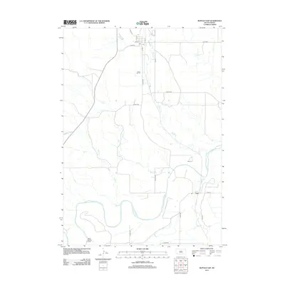
2012 Map of Buffalo Gap
USGS Topo · Published 2012About this map
Buffalo Gap sits at the northern end of this Custer County landscape, where the street grid of Main St and Cedar St meets the winding path of Beaver Cr. The terrain here is defined by a dense network of waterways that converge as they flow toward the Cheyenne River in the south. Several significant creeks, including Spring Cr and Elm Cr, cut across the plains, illustrating the drainage patterns that shaped early settlement in this part of South Dakota.
Find a feature on this map
27 named features on this map. Tap any name to fly to it.
Don’t see what you’re looking for? This feature index may not catch every label — zoom into the map to look around manually.
Map Details
Editions of this 2012 Buffalo Gap Map
This is the sole edition of this map. No revisions or reprints were ever made.
Other maps of this area

1894 · Hermosa
USGS Topo · 1:125,000

1896 · Oelrichs
USGS Topo · 1:125,000

1900 · Oelrichs
USGS Topo · 1:125,000

1901 · Hermosa
USGS Topo · 1:125,000

1950 · Hot Springs
USGS Topo · 1:24,000

1950 · Buffalo Gap
USGS Topo · 1:24,000

1950 · Hot Springs SE
USGS Topo · 1:24,000

1950 · Angostura Reservoir
USGS Topo · 1:24,000

1951 · Smithwick NW
USGS Topo · 1:24,000

1955 · Hot Springs
USGS Topo · 1:250,000