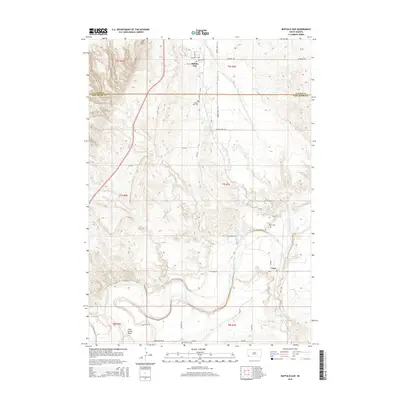
2015 Map of Buffalo Gap
USGS Topo · Published 2015About this map
Buffalo Gap sits at the northern edge of this landscape, marking the historic transition between the Black Hills and the surrounding plains. The settlement is defined by a grid of streets including Main St and Walnut St, serving as a focal point for the surrounding ranching and agricultural land. To the south, the village of Oral rests near the banks of the Cheyenne River, which snakes across the bottom of the map.
Find a feature on this map
30 named features on this map. Tap any name to fly to it.
Don’t see what you’re looking for? This feature index may not catch every label — zoom into the map to look around manually.
Map Details
Editions of this 2015 Buffalo Gap Map
This is the sole edition of this map. No revisions or reprints were ever made.
Other maps of this area

1894 · Hermosa
USGS Topo · 1:125,000

1896 · Oelrichs
USGS Topo · 1:125,000

1900 · Oelrichs
USGS Topo · 1:125,000

1901 · Hermosa
USGS Topo · 1:125,000

1950 · Hot Springs
USGS Topo · 1:24,000

1950 · Buffalo Gap
USGS Topo · 1:24,000

1950 · Hot Springs SE
USGS Topo · 1:24,000

1950 · Angostura Reservoir
USGS Topo · 1:24,000

1951 · Smithwick NW
USGS Topo · 1:24,000

1955 · Hot Springs
USGS Topo · 1:250,000