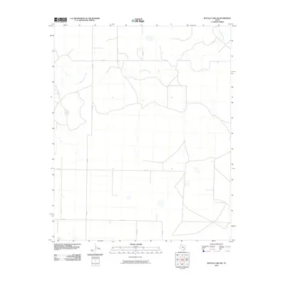
2010 Map of Buffalo Lake SW
USGS Topo · Published 2010About this map
Tierra Blanca Creek meanders across this High Plains landscape in Randall County, defining the primary drainage pattern of this rural Texas territory. The map reflects a classic Panhandle section-line layout, where a network of county roads including Co RD Aa, Co RD BB, and Co RD 5 partition the terrain into expansive agricultural or grazing blocks. In the southern reaches, FM 1259 provides a primary paved artery through the quadrangle. The sparse distribution of labels emphasizes the area's open, rural character, dominated by topographical contours and the essential watercourse of the creek. Researchers can observe the intersection of local infrastructure and natural hydrology, illustrating how property lines and transport routes respect the winding path of Tierra Blanca Creek.
Find a feature on this map
10 named features on this map. Tap any name to fly to it.
Don’t see what you’re looking for? This feature index may not catch every label — zoom into the map to look around manually.
Map Details
Editions of this 2010 Buffalo Lake SW Map
This is the sole edition of this map. No revisions or reprints were ever made.
Other maps of this area

1954 · Clovis
USGS Topo · 1:250,000

1958 · Clovis
USGS Topo · 1:250,000

1961 · Buffalo Lake
USGS Topo · 1:62,500

1966 · Jumbo
USGS Topo · 1:24,000

1966 · Nazareth NW
USGS Topo · 1:24,000

1966 · Arney
USGS Topo · 1:24,000

1971 · Hereford NE
USGS Topo · 1:24,000

1971 · Hereford SE
USGS Topo · 1:24,000
1984 · Dawn
USGS Topo · 1:24,000
1984 · Umbarger
USGS Topo · 1:24,000